
Reasons for the formation of Son Doong Cave

Why Quang Binh, Vietnam – a relatively small area – has so many caves, including three of the world’s largest by volume (like Son Doong):
Reason for cave formation
For a cave to form, the region must be a karst region- Basically, a karst region is a distinctive geological landscape formed on limestone that has been eroded by rainwater and groundwater over millions of years. The dissolution of limestone creates vast cave systems, sinkholes, dry valleys, and many other unique landforms found nowhere else. Millions of years ago, this area was likely a shallow sea, home to coral reefs. Over repeated cycles of life and death, the remains of these corals accumulated over millions of years, forming extensive limestone regions (similar to Ha Long Bay, Ninh Binh).
Then, rainwater (which carries CO₂ from the air, combined with hydrogen ions (H⁺) to form carbonic acid) flows down and gradually dissolves the limestone (CaCO₃).
So why don’t other types of rocks, like basalt or granite, dissolve in rainwater? Because these rocks are chemically very stable and complex, and they cannot be easily eroded by weak acids like H₂CO₃.
Heavy Rainfall
Although the total annual rainfall in this region may not be the highest in the world, the rainfall over a short period can be extremely intense. For example, on November 5th, some locations in Quang Binh received 580 mm of rain in 24 hours, while the average annual rainfall in Paris is 641 mm.
The reason lies in two main factors: the northeast winds and the Bach Ma mountain range.
First, cold air masses from mainland China continuously move south, driving strong northeast monsoon winds toward Central Vietnam. When these winds reach Hue and Da Nang, the cold air meets the warm sea, picking up additional moisture and forming a dense, humid air mass. When this air encounters the Bach Ma mountains, whose orientation and terrain act like a funnel, the air is forced upward, causing strong condensation and prolonged heavy rainfall.
Bach Ma is not the highest mountain range in Vietnam, but it is one of the steepest. Due to the right-angle effect, the northeast winds carrying moist air are easily pushed up to the peaks, forming continuous clouds and sustained rain.
Narrow U-shaped terrain
As you may notice, Vietnam’s S-shaped region is very narrow, with the Truong Son Mountains to the west and the East Sea (South China Sea) to the east. On the mountain side, water drainage is limited, while the sea, which should ideally serve as an outlet, is lined with long sand dunes.
Places like Hue, Quang Binh, Mui Ne, and Binh Thuan all have high sand dunes. Mui Ne and Quang Binh are particularly famous for sand-related tourism activities, such as sand sledding and sand dunes Jeep tours.
Heavy rainfall combined with poor drainage creates the Central Vietnam region’s tendency for floods in late October. Although modern technology and engineering have introduced many effective methods for drainage and flood prevention — especially in urban areas — severe, large-scale flooding has become far less common in cities. Rural areas, however, still experience regular seasonal flooding. Yet nature remains unpredictable. Exceptional events, like the recent flood in 2025, can still occur — the previous major flood before this was in 1999.
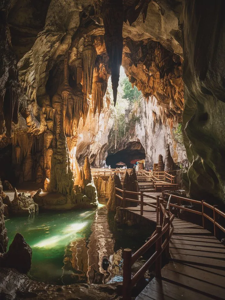
The Cave Systems of Quang Binh
Heavy rains chemically erode the limestone, while powerful floods contribute to its mechanical erosion. Over millions of years, this process has carved out the extensive cave systems found in Quang Binh:
Son Doong Cave, the largest cave in the world by volume, contains its own ecosystem with forests, rivers, and lakes inside the cave, much of which remains unexplored.
Paradise Cave (Hang Thien Duong), a massive cave renowned for its stunning stalactite formations.
Tu Lan Cave, featuring lakes and colorful rock layers around the cave, creating a scene reminiscent of a fairytale.
En Cave (Hang Én), another spectacular cave in the region.
Read more about An Bang, The city of Ghost - Another Hue' story
Read more about An Dinh Palace and its Origin - Another Chapter of Hue's Heritage


